
Hoping to not get lost on the Appalachian Trail? Let me take you through three resources which will help you immensely on your adventure:
1. 2018 Northbound or Southbound A. T Guide by David “Awol” Miller
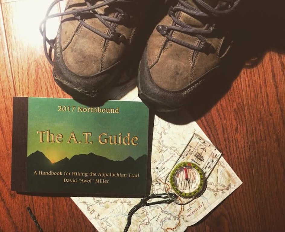
I can’t praise this guidebook enough. Before going on the trail I spent quite a bit of time looking up what map/guide to get and everyone recommended this one. It’s easy to see why, it’s incredibly detailed and well thoughtout. It shows milage markers as you hike along and elevation profile maps. It also indicates thousands of landmarks such as campsites, water sources, summits and gaps which makes it super easy to plan your way on the trail. Using the guide book, you can figure out where to stop to re-fill and filter your water, and I used it to check up on how far along I was and how much further there was to go until my shelter for the night. Another great feature of the guidebook is it has tons of info and resources on re-supply points on the trail. It has outlined accommodation details, shuttle services, grocery stores, phone numbers and all the info you need for every trail town. This was so helpful in figuring out what towns to re-supply in.
2. Guthook’s Appalachian Trail Guide App
When I was on the Trail most people had this awesome app for their phone and I wish I had downloaded it before I left on my trip. Guthook’s map-based smartphone guide doesn’t use any data or require wifi, instead it uses your phones GPS. It shows you where you are on the trail and how close you are to water sources and shelters. It’s free to download but then you have to pay for the maps for the sections of the trail you are hiking. The coolest thing about this app is it tells you exactly how far you are away from landmarks, whereas with the guide book you have to calculate that using math and guessing how far you are in between. So in summary, it will tell you where you are faster than using a guide book. Here’s the kicker: if your phone runs out of battery while on trail then you will be SOL (shit out of luck). So I would encourage not solely depending on the app, instead, bringing a guide book as well. Tips: put your phone on airplane mode to save battery and bring a mini portable charger just in case it runs out before you get to your next re-supply point/trail town.
3. A Compass:
Call me old school but having a compass gave me a huge sense of security on the trail. This is mostly because there is the thought in the back of your head that asks: “What if get completely off the trail somehow and have to find my way in the woods?” Having a compass will at least tell you what direction you’re heading in so that you’re not walking in circles till you eat up all of your ramen noodles rations and die. The trail is super well marked and you have to be pretty stupid to wander off the trail somehow, but having a compass puts me at ease. I got just a simple one from MEC (Mountain Equipment Co-op) but you can use whatever you already own (preferably lightweight).
 With these three resources on hand you will be all set on navigating your way on the Appalachian Trail. Wishing you a safe and absolutely amazing adventure!
Happy Trails!